Catalogue GéoJura
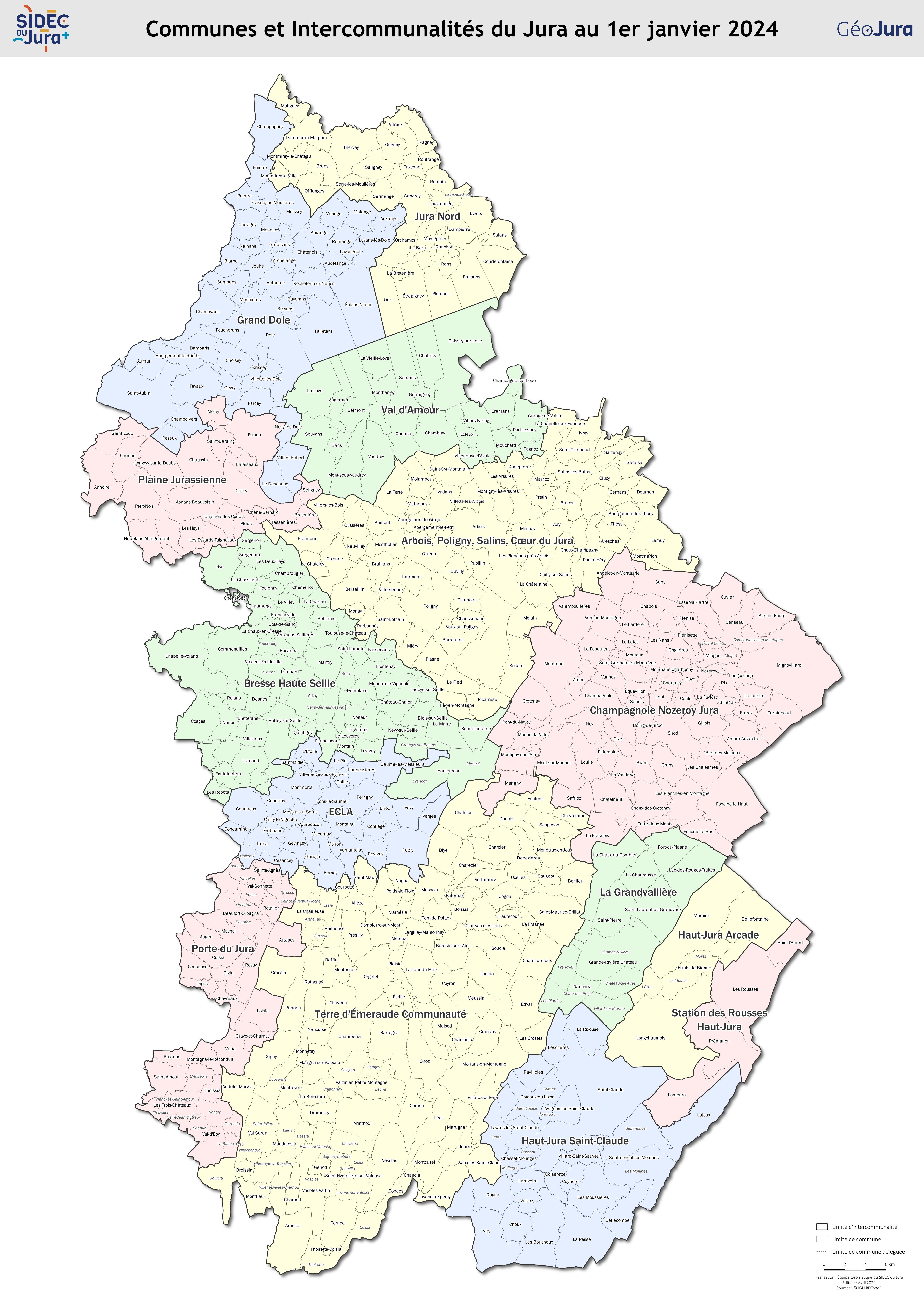
Carte administrative du Jura
Carte du découpage administratif du département du Jura (communes et intercommunalités) au 1er janvier 2025.
Simple
- Date (Creation)
- 2025-01-01
- Citation identifier
- 7c508743-dbda-4669-9d2e-987f0982b7ee
-
GEMET - INSPIRE themes, version 1.0
-
-
Territoire de compétence
-
- Theme
-
-
Communes
-
EPCI
-
jura
-
Carte
-
OpenData
-
Open Data
-
- Use limitation
-
Données ouvertes
- Access constraints
- Other restrictions
- Other constraints
-
Données ouvertes
- Spatial representation type
- Vector
- Language
- Français
- Topic category
-
- limites-administratives
- Hierarchy level
- Dataset
- File identifier
- 7c508743-dbda-4669-9d2e-987f0982b7ee XML
- Metadata language
- Français
- Hierarchy level
- Dataset
- Date stamp
- 2025-03-20
- Metadata standard name
-
INSPIRE Metadata Implementing Rules
- Metadata standard version
-
Technical Guidelines based on EN ISO 19115 and EN ISO 19119 (Version 1.2)